We live in an era where data is everything, and thanks to AI, we finally have the computational power to process vast amounts of information. But here’s the challenge: our planet is changing faster than we can monitor it.
Extreme weather events are happening at an increasing rate. In the USA alone there’s a billion dollar catastrophe every three weeks somewhere in the country and the total number of catastrophes per capita has quadrupled in the last couple of decades. More growth in areas near underdeveloped land means that more people are at risk of the impacts of natural disasters. More infrastructure due to increased urbanization brings new challenges to monitoring and managing our built environment.
To be able to monitor this change, understand it and be prepared for it a higher perspective is required. As Kurt Gödel proved, any sufficiently complex system can not contain the tools to see the whole picture. A scalable external observation is required. And current Earth monitoring systems are fundamentally misaligned with that pace. In fact, we’re still using aerial imaging methods from the 1950s: expensive aircraft flying inefficient “lawnmower” patterns. Meanwhile, the resolution and update frequency of satellite imagery are often insufficient for conducting detailed and timely analysis.
The data coming from the status quo is low quality and is a collection of sporadic snapshots. This is the equivalent of making a stock pick with 2 year old financial data, it makes no sense and would be completely irrelevant. The world is changing too fast, and the systems we have aren’t built to keep up with the pace and precision. At Near Space Labs we totally re-envisioned the earth imagery stack to provide a new category of earth monitoring. Our solution combines super high resolution, frequency, and recency at scale:
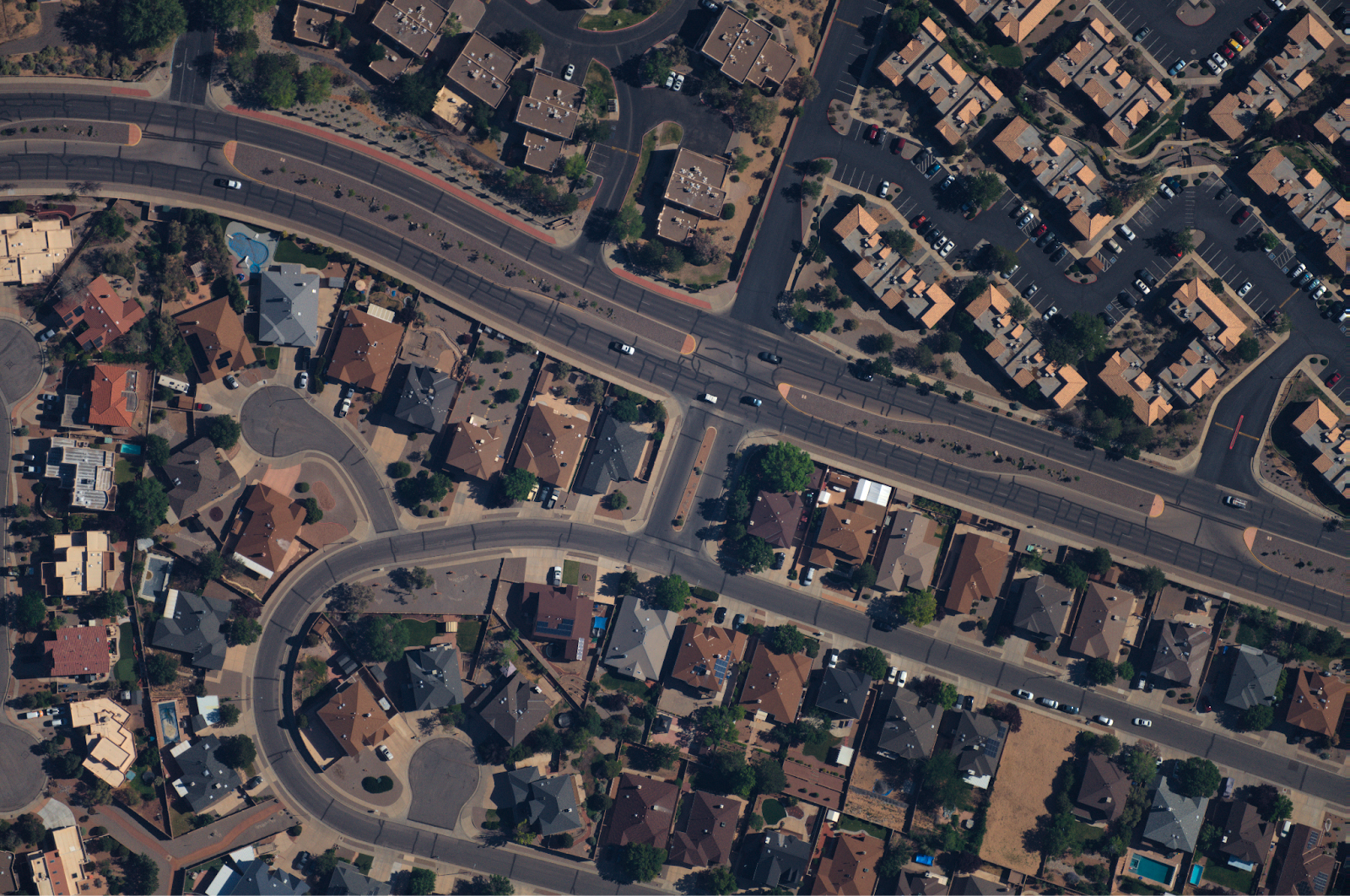
Resolution: Consistent 7 cm resolution across cities, towns, and rural areas.
Geographic Accuracy: Sub-meter geo-referencing accuracy for precise mapping of objects like shingles.
Frequency & Recency: High-cadence capture, with frequency and recency of capture fully tailored to customer needs.
Scalability: Continent scale capture, bringing data equitability to every corner of the country.
Speed: Rapid deployment and persistent monitoring, crucial for example in disaster monitoring.
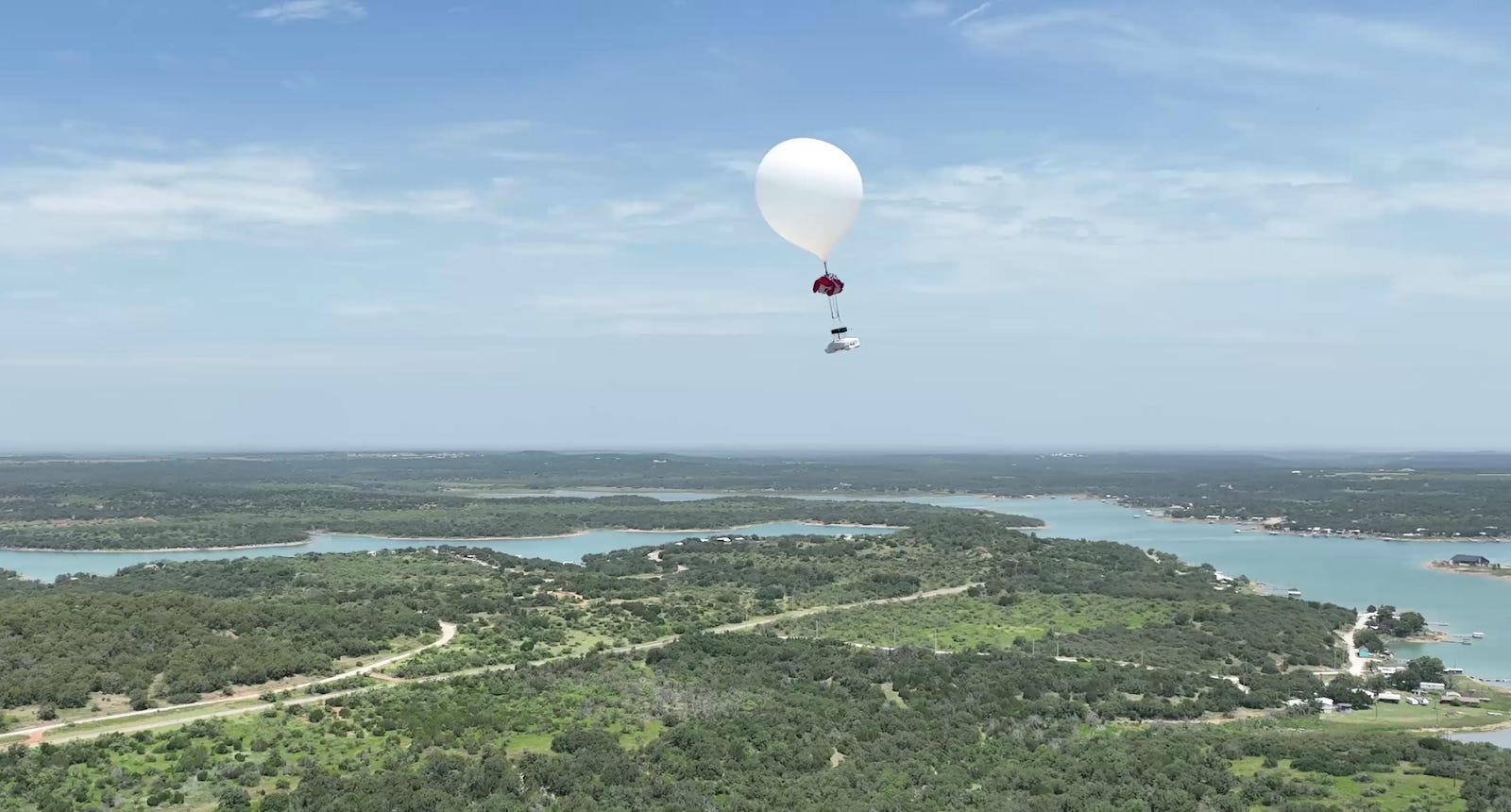
How do we do this? We operate a complex hardware, software, and operations stack to deliver the imagery at scale. At the heart of our innovation is the stratospheric robot Swift, that flies 2-3 times higher than airplanes, in the stratosphere between 60k - 100k ft altitudes. The focus on shifting to a stratospheric perspective is reflected in the very name of our Swift robots. Just like the swift bird they are named after, which is capable of flying higher than nearly any other species, our Swift robots similarly operate in the strategic height between planes and satellites.

Once launched, the Swift operates completely autonomously. Our proprietary AI software handles mission planning, flight control, and data capture. The system can be deployed from anywhere, literally from the roadside with a pickup truck, no airports or extensive ground support required. And because the Swift operates entirely on wind currents, it’s zero-emission, launch to landing.
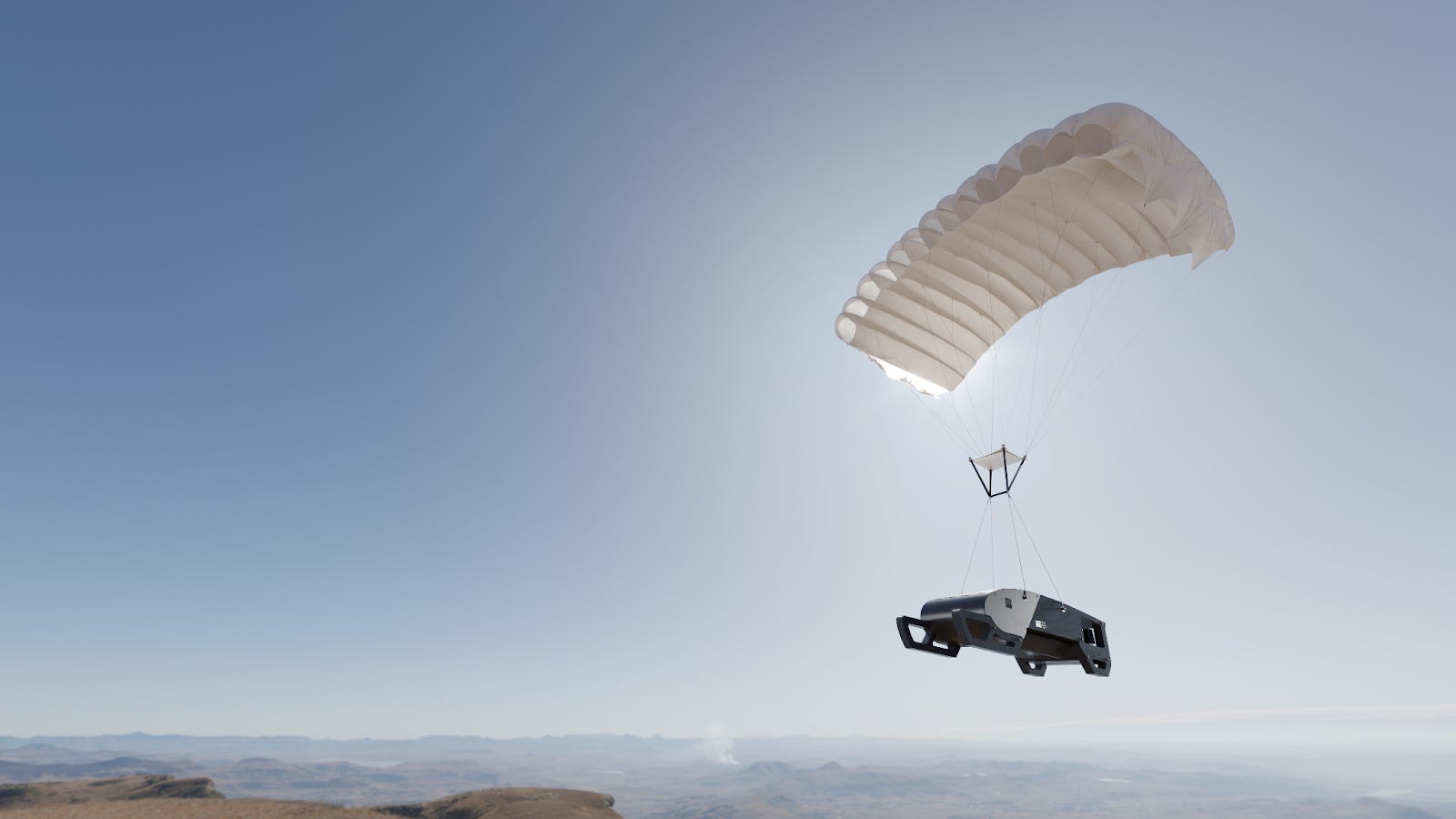
The Swift captures the ultra-high resolution imagery using sophisticated robotics to control both flight and imaging operations. The robotic gimbal automatically steers and stabilizes our proprietary sensors to ensure precise coverage of target areas. And once a mission is complete, the paraglider system allows for autonomous controlled descent and landing at predetermined locations. The imagery serves a variety of purposes across insurance, home & building services, utilities, and infrastructure — powering decisions in industries where clarity and timing are everything.
A single Swift flight covers approximately the size of the D.C. metropolitan area in a couple of hours. To put that in perspective, it would take 800,000 drone flights over many weeks to cover that same area. We combine the strengths of high-resolution but localized drone coverage and low-resolution, wide-coverage satellite imagery. A category-defining solution with high-resolution imagery, wide-scale coverage, and unprecedented frequency of capture.
The story of progress has always been about sharper tools for seeing: the telescope, the microscope, the satellite. At Near Space Labs, we’re writing the next chapter. The stratospheric era of Earth intelligence, where clarity becomes a form of resilience.