Our Tech
The Swift is the backbone of Near Space Labs' technology platform, and represents a first in high-altitude data capture: autonomous, precise, and rapidly deployable at scale. In hours, our Swifts can survey an area as large as New York City.
Get a Demo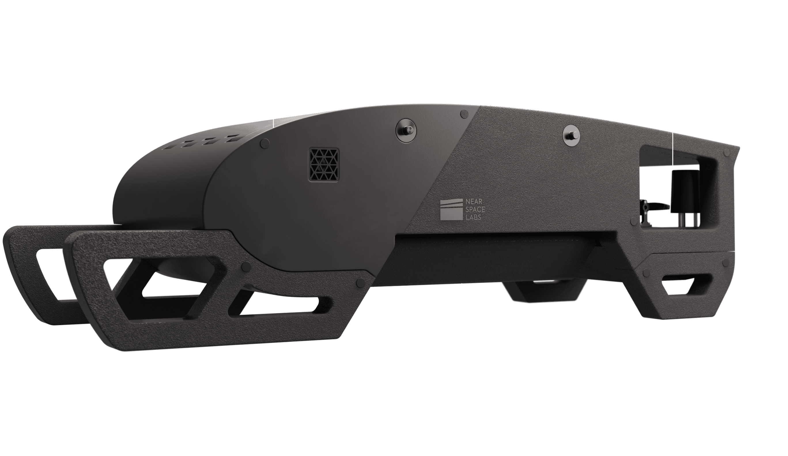
To make Earth observation scalable, Near Space Labs threw out the old playbooks. We designed the Swift from the ground-up to be modular, extensible, and easy to deploy. We integrate new payloads in weeks rather than years — whether that is incorporating thermal infrared for wildfire detection, or custom sensors for infrastructure monitoring.
Adaptive mission control, from launch to landing
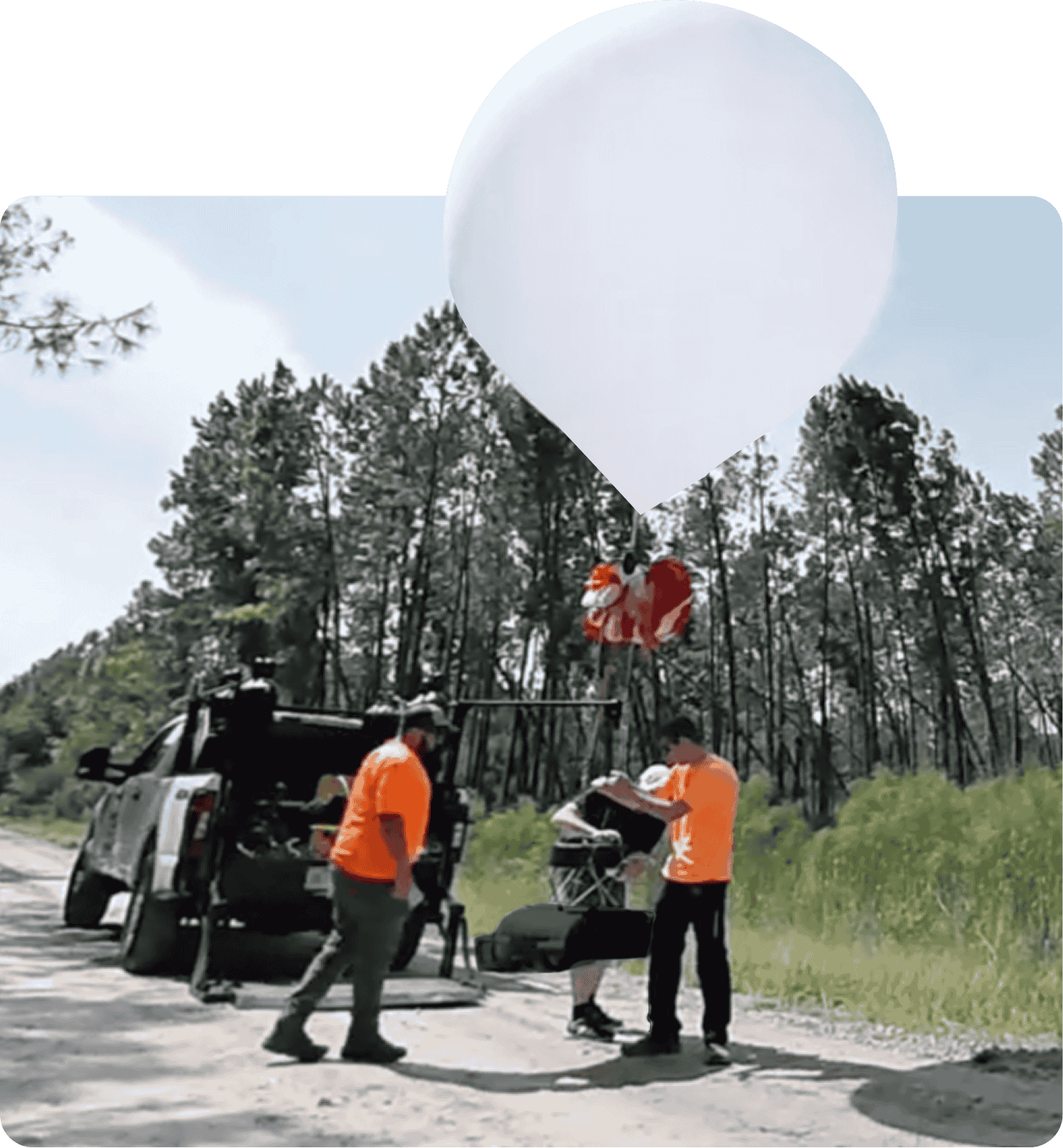
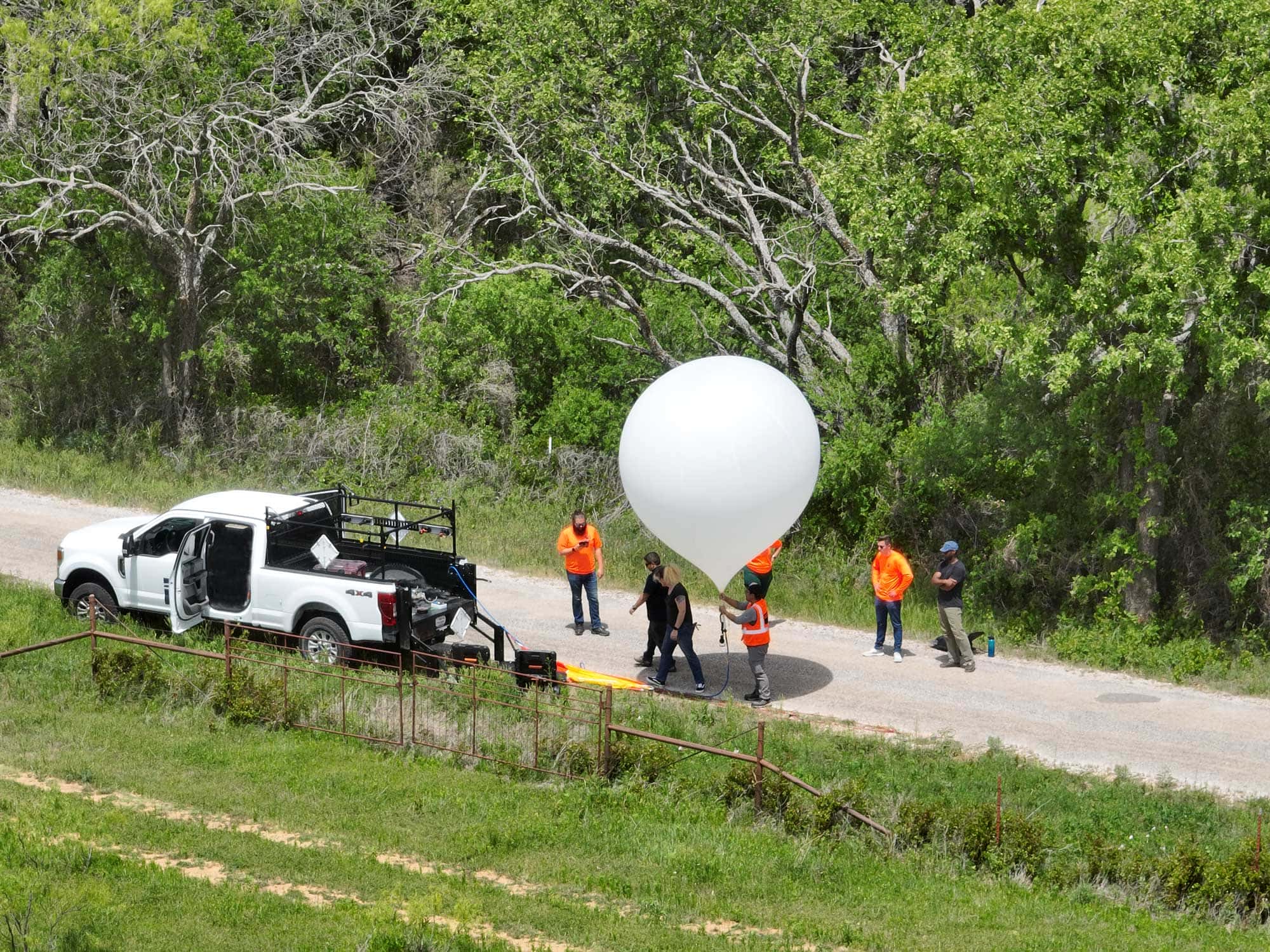
Rapid and flexible launch
Swifts do not require an airfield, set schedule, or direct access to a survey area to operate. We need less than 20 minutes to launch a mission, and can do so from hundreds of miles away from a target area.
Autonomous fleet control
Flights are managed via StratoMap, our proprietary flight operations software. With fleet configurability, multiple Swifts can be coordinated in a single mission to cover hundreds of square miles.
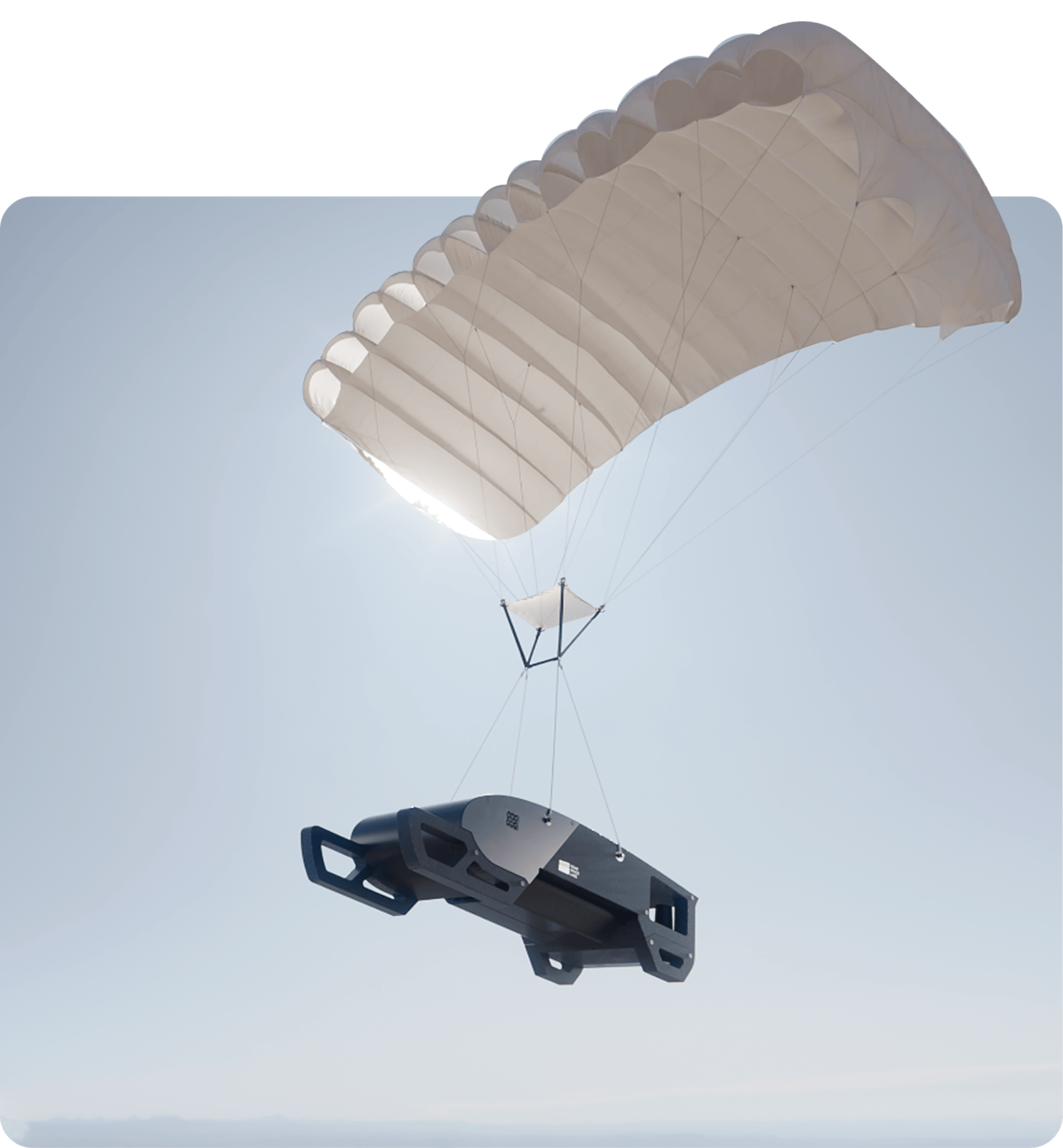
Landing and recovery
Our precise landing systems allow for rapid recovery and redeployment. Minimal downtime allows us to make the most of our operations.
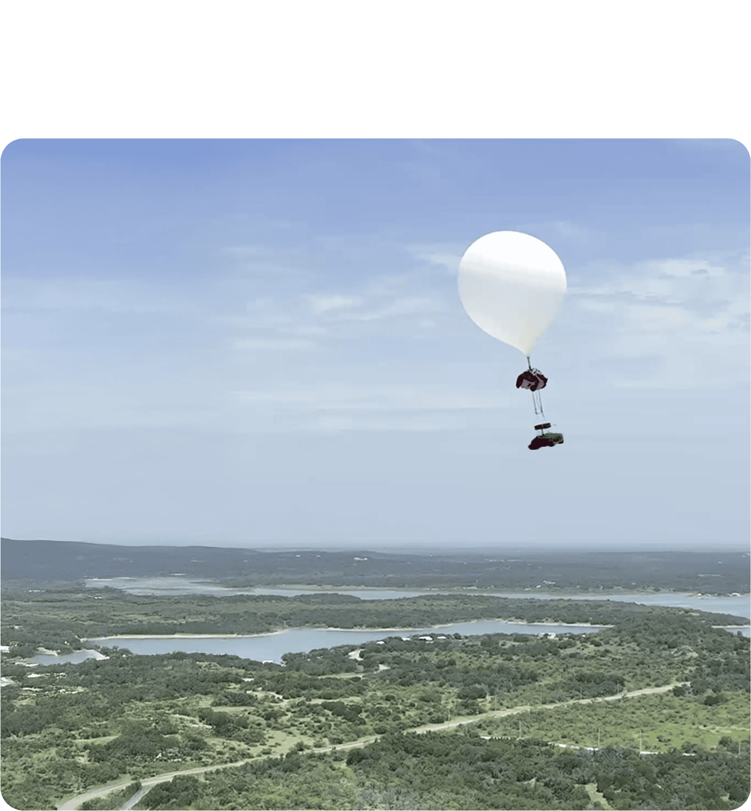
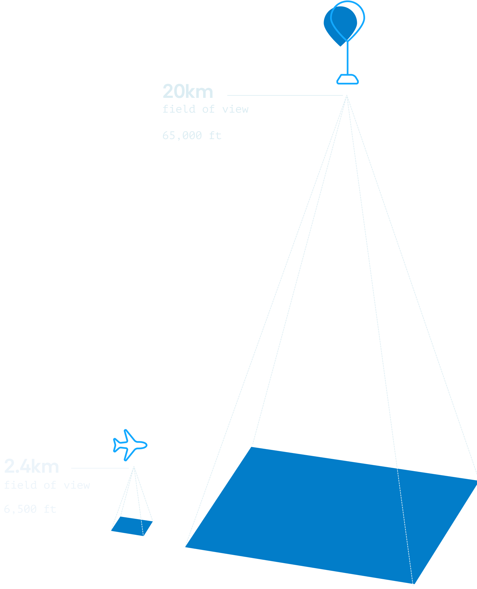
The stratospheric difference
By commercializing stratospheric data capture, Near Space Labs has unlocked a new paradigm in Earth observation. For the first time, it is possible to have the wide-area view of a satellite combined with the high resolution of a drone or fixed-wing aircraft.
AI-powered data processing delivers quality at industry-leading speeds
Delivering data quickly and consistently to decision-makers is what makes the difference. Our AI-powered processing pipeline ensures that data collected from the stratosphere is georeferenced, orthorectified, normalized (and more) without the need for manual quality assurance.
By reducing the time between data capture and publishing, Near Space Labs puts analysis-ready information in the hands of users and OGC-compliant GIS applications within days or weeks — not the months-long timeframes typically seen in the geospatial industry.
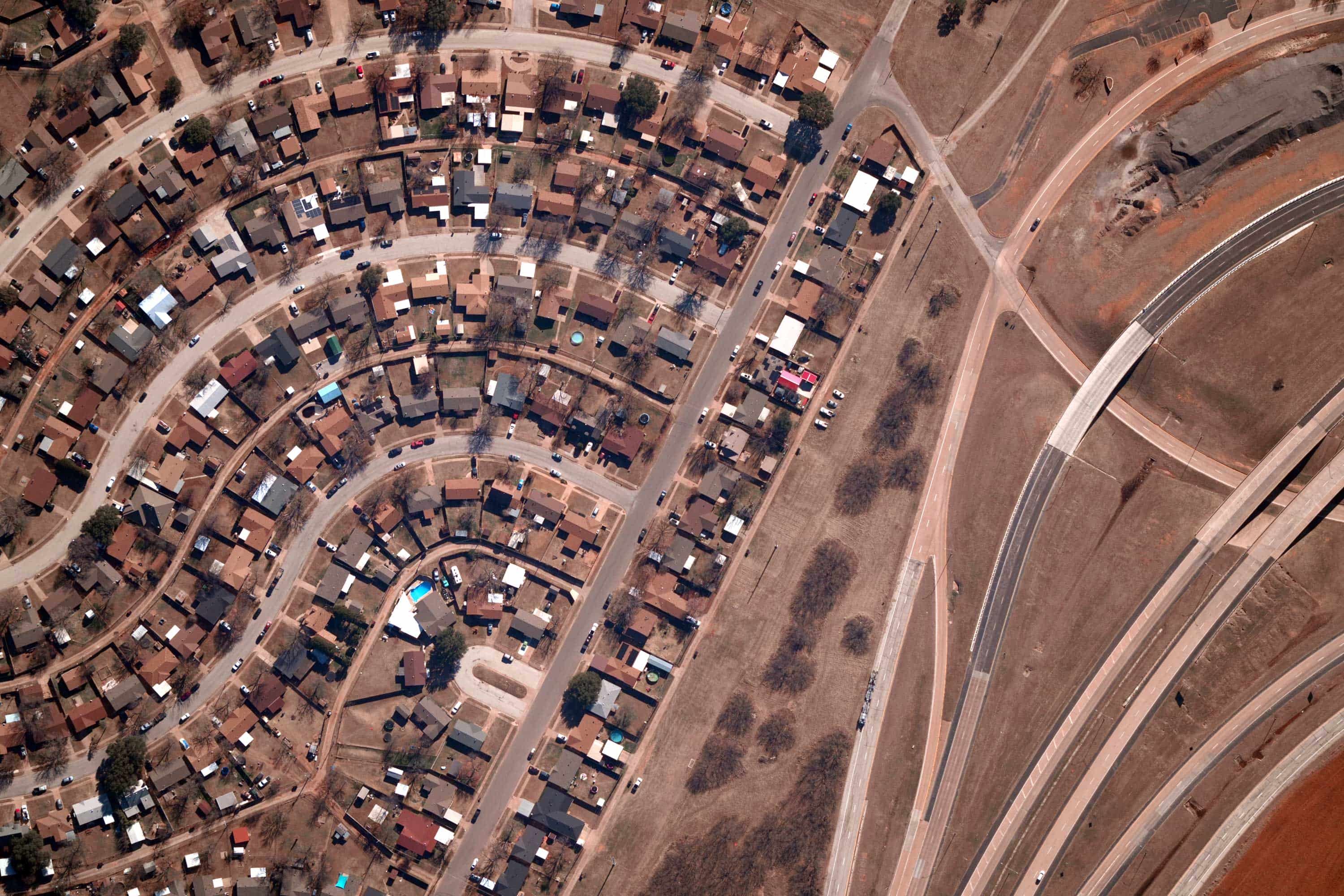
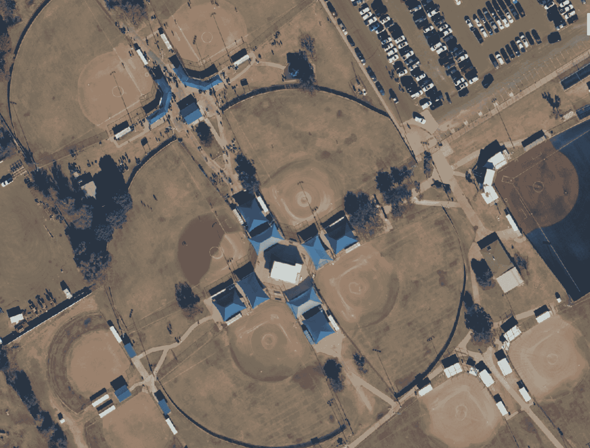
What our high-resolution imagery and data enables
7cm resolution reveals details that matter, whether you're assessing property conditions, monitoring vegetation, or tracking infrastructure in remote areas.
Our geospatial data captures structural features, surface conditions, vegetation health, and environmental changes at a level of granularity that satellite imagery simply cannot match.
This granularity drives sharper insights across a wide range of use cases, from risk modeling and underwriting to urban planning and construction monitoring —without costly manual surveys or inspections.


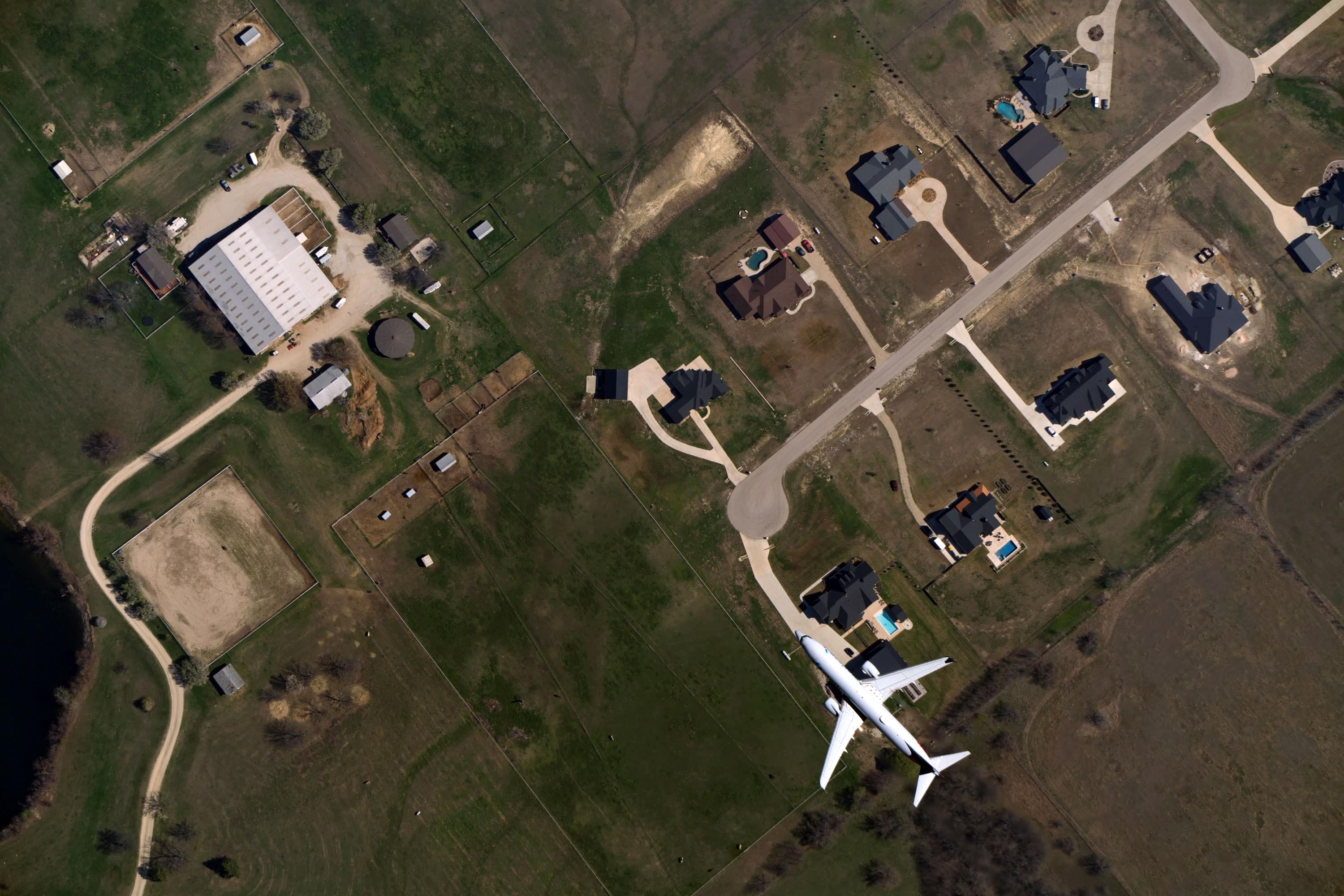
Safe practices in the sky
Since day one, saftey has been a top priority for Near Space Labs. Every Swift is equipped with ADS-B transponders so that it can broadcast position data to aircraft and air traffic control systems in real time.
In addition, every Near Space Labs' mission is coordinated directly with local air traffic control and the Federal Aviation Administration to ensure safe and compliant operations from launch to recovery.