Nationwide Program
Consistent 7cm coverage, refreshed 2x a year
High-resolution orthoimagery for 80% of the U.S. population, updated twice per year. A consistent foundation for monitoring, planning, and decision-making at any scale.
Get a Demo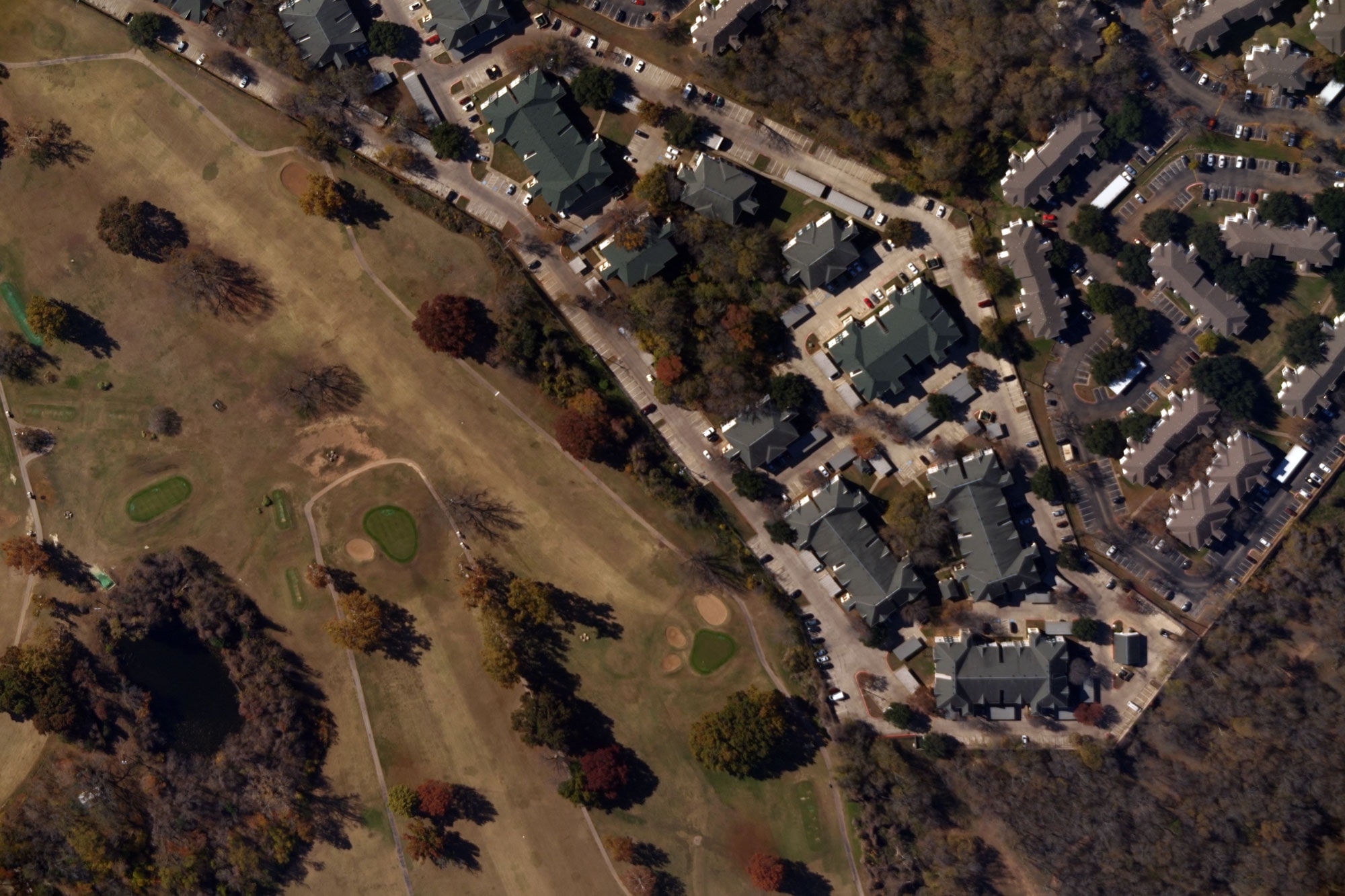
What You Get
2x per year refresh
Receive imagery updates twice per year, with leaf-on and leaf-off capture, for a current view of metropolitan and suburban areas.
80% of the U.S. population
Get extensive coverage across all major regions of the U.S.
7cm resolution everywhere
Benefit from the same high-resolution clarity everywhere data is captured. No compromises in rural or less densely populated areas.
Flexible data licensing
Build in-house analytics or value-added products with flexible licensing rights that support business continuity.
Why this matters
Legacy imagery programs force a tradeoff: frequent updates or wide coverage, high resolution or cost effectiveness. Near Space Labs eliminates those tradeoffs. We capture 7cm vertical imagery cost effectively from the stratosphere, with twice per year refresh for 80% of the U.S. The result is a predictable, reliable data foundation for your organization.
Who this serves
State & Local Government
- GIS & Urban Planning
- Property Assessment
- Risk Mapping & Mitigation
- Public Works
- Transportation
Energy & Utilities
- System Mapping & Planning
- Asset Inspection
- Vegetation Management
- Wildfire Mitigation