Energy & Utilities
Plan and monitor system assets with confidence
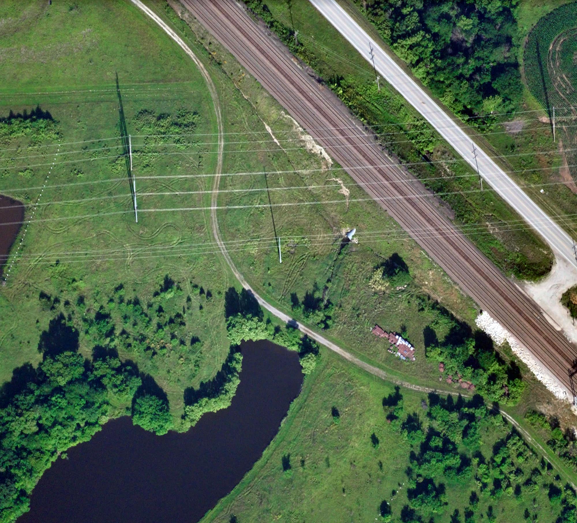
Energy and utility companies need consistent visibility into power lines and distributed assets to support system mapping, prevent outages, manage vegetation encroachment, and maintain regulatory compliance. Near Space Labs delivers 7cm resolution imagery and monitoring capabilities that keep your infrastructure visible and your operations running.
Get a Demo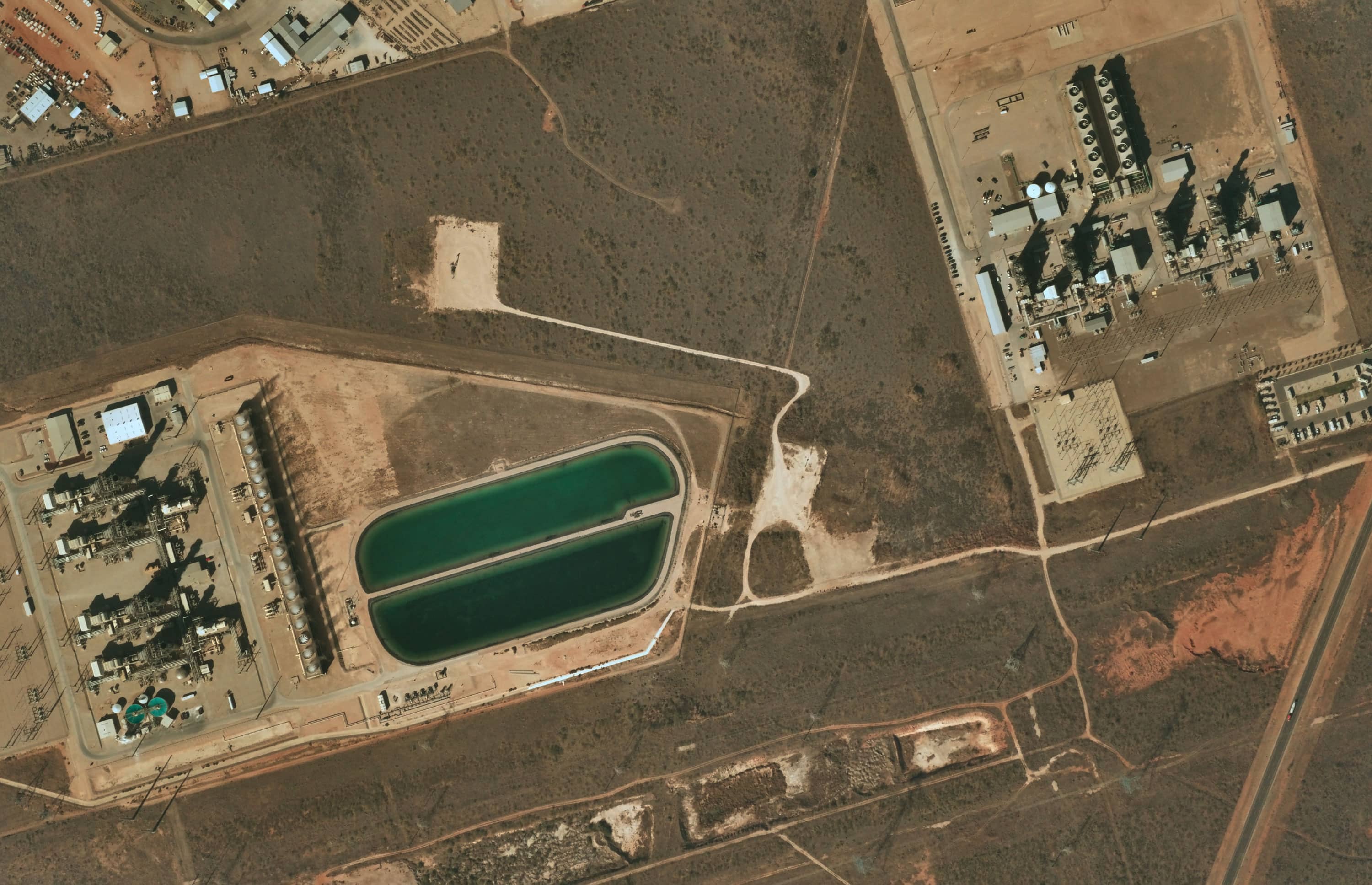
Supercharge your network visibility, from assets to environment
The Challenge
Utility networks span vast terrain, and outdated basemaps make it hard to stay ahead of what's changing. Satellite imagery lacks the resolution to catch vegetation encroachment, equipment deterioration, or landscape shifts around power lines, poles, and facilities before they become operational problems.
Our Approach
Near Space Labs delivers 7cm resolution imagery across transmission corridors, poles, substations, and surrounding facilities on a predictable schedule. Monitor vegetation and wildfire interface zones, keep asset maps current, and support long-term system planning as your network grows to meet new development and rising demand.
Outcomes for Energy & Utilities
Enhanced vegetation management
Right-of-way monitoring
Asset inspection and maintenance planning
System mapping and network planning
Accurate, high-resolution imagery for every scale and application
.jpg)